Difference between revisions of "How to use Haskell for GIS"
| Line 1: | Line 1: | ||
[[Category:GIS]] |
[[Category:GIS]] |
||
| + | |||
| + | In development ... |
||
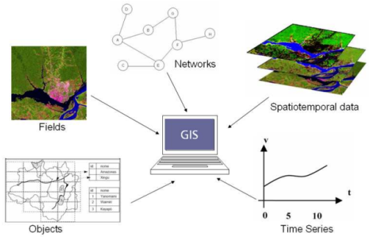
Developing geographic information systems is a complex task. GIS applications involve data handling, algorithms, spatial data modeling, spatial ontology and user interfaces. The diversity of structures such as networks, fields, objects, time series and spatial temporal data types , is an intimidating problem for GIS developers. |
Developing geographic information systems is a complex task. GIS applications involve data handling, algorithms, spatial data modeling, spatial ontology and user interfaces. The diversity of structures such as networks, fields, objects, time series and spatial temporal data types , is an intimidating problem for GIS developers. |
||
Revision as of 09:29, 27 November 2009
In development ...
Developing geographic information systems is a complex task. GIS applications involve data handling, algorithms, spatial data modeling, spatial ontology and user interfaces. The diversity of structures such as networks, fields, objects, time series and spatial temporal data types , is an intimidating problem for GIS developers.
Research in Geographic Information Science has shown that many spatial data can be expressed as algebraic theories. These algebraic theories formalize spatial components in a rigorous and generic way. As an answer to the challenges of translation of algebraic specifications into computer languages, there has been a growing interest in functional languages. So, the TerraHS is an application development system that enables prototyping novel GisScience ideas in Haskell.
We have developed TerraHS, a software component that enables the development of geographical applications in a functional language.
